Photogrammetry is the science of combining multiple overlapping images to create a single overview image and 3D model of an area or object. TerraDrone use this technique by capturing overlapping imagery from cameras mounted on drones. The drone can be flown manually or pre-programmed to follow a defined route along which the camera takes images at defined points. This data is passed on to data processing teams in our offices who then process this data to produce single overview images and 3D models. By combining data with GPS control from the site the team can produce data with known levels of accuracy which are reported alongside the data delivery.
The output file formats from this process can be varied and offer clients a great deal of versatility and insight. Data can be viewed in almost any GIS or CAD software package.
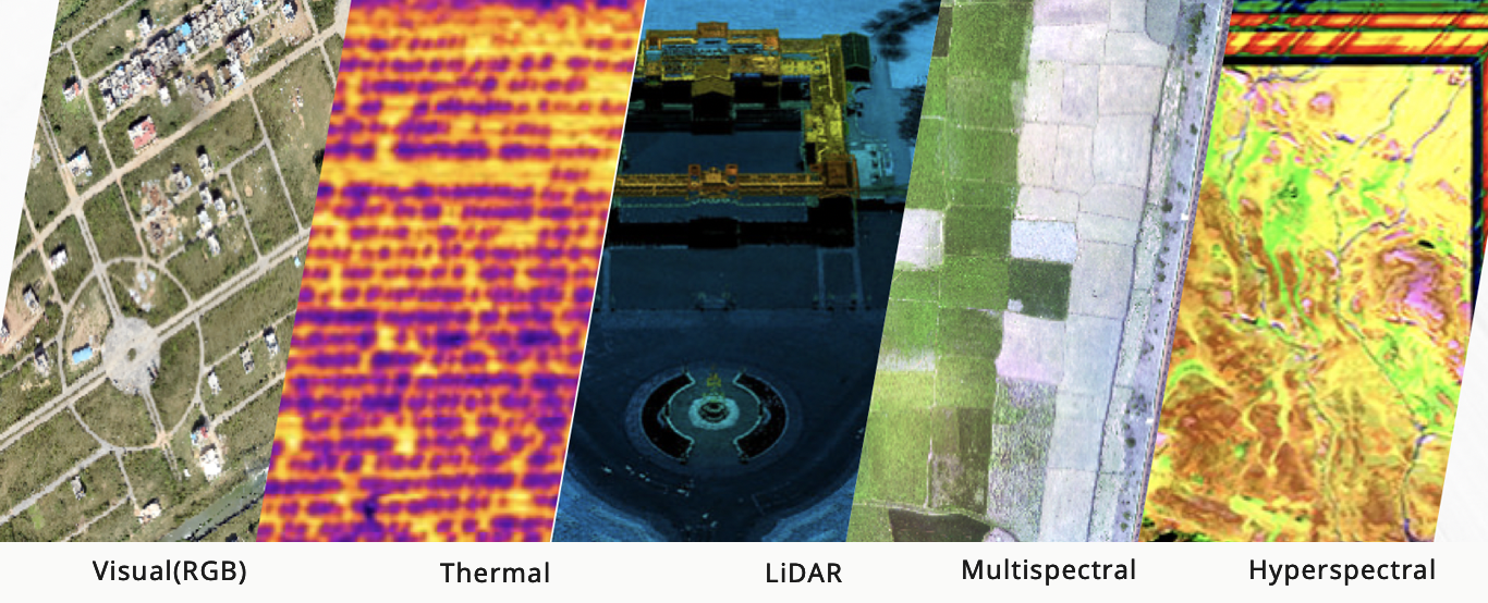
LIDAR
Lidar is a surveying method that measures distance to a target by illuminating that target with a laser light and measuring the return signal. The difference between the time the pulse was sent and when the pulse was received is an indication of the distance of the target. The LiDAR sensor perform this task hundreds of thousands of times per second as the drone flies. The result is a high-density point cloud which provides a 3 dimensional representation of the area flown.
The subsequent LiDAR data can be further analysed to measure the intensity of each return signal from which our data analysts can use to classify the point cloud.
GIS
We provide aerial multi-sensor surveyingand photogrammetry services.We render high-precision and low-cost services using proprietarysurvey technology.We offer a complete solution set from surveyingto data analysis and 3D modeling.
Terra Drone provides geospatial services and data management, processing and export services. Our range of geospatial services includes data generation, manipulation, management, conversion, migration, and maintenance for GIS and other information management systems. We ensure successful geospatial data implementation.
Offering the finest consultancy services for GIS solutions as well as software development solutions to the global geospatial market, Terra Drone combines its strong domain knowledge and cutting-edge technology to provide competitive advantage to its clients.
When it comes to capturing large amounts of detailed mapping data, leveraging drones makes the process exponentially faster and more accurate while giving clients a near-real-time control over data.
Acquisition of images with high ground resolution.
Most efficient and economical solution. At Terra Drone we assist our clients and handhold them through every step of the project. Starting right from the primary step of field reconnaissance survey to UAV data acquisition and pre- and post- processing of the acquired data, we have a dedicated team to perform all these actions with a professional edge.
Call us!
Get a free consultation to maximize the use of drones in your company now.
")